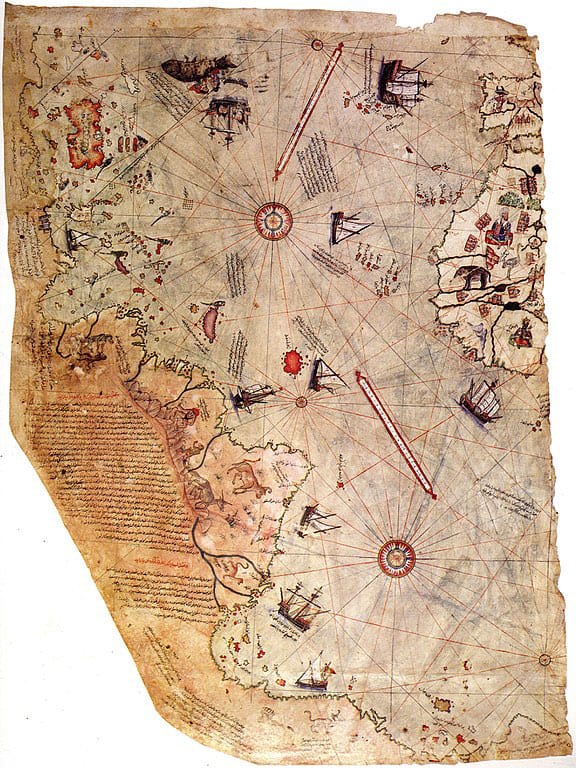
Early Maps of the Globe (September 24)


As difficult as it is to imagine, during the Ice Age, people were measuring and mapping the globe. The Piri Reis map, dating from 1513, has an accurate rendering of Antarctica and its coastline. It was not until 1949 that sonar mapping discovered where the coastline is located – underneath 5000 feet of solid ice. Yet, this map and another drawn by Oronteus Finaeus in 1531 showed Antarctica with mountain ranges, rivers, and bays prior to becoming covered by thousands of feet of snow and ice.
These two maps were a compilation of information that was moved from the Library of Alexandria in Egypt to Turkey before that great ancient depository of knowledge was destroyed by fire. The Turkish cartographers wrote on these maps that their source maps were made by the ancient seafarers, Phoenicians. Antarctica was officially “discovered” by the Russians in 1818 AD, or should I say, rediscovered! During the Ice Age, the very warm ocean floodwaters (from the fountains of the deep, volcanism, and plate tectonics) would have kept the coastline of Antarctica free from ice for centuries. Eventually, as the oceans continued to cool, great ice sheets covered it, as we find it today.
The one and only Ice Age took place just after the Flood (2348 BC) and is believed to have lasted about 700 years – 500 years to build up and 200 years to melt down. This would have provided ample time for the ancient explorers to sail the seas and map the globe before Antarctica was permanently covered by ice. These maps provide EXTREMELY convincing evidence that the biblical understanding of Earth’s history is correct.
Psalm 107:23
KJV: They that go down to the sea in ships, that do business in great waters;
NIV: Some went out on the sea in ships; they were merchants on the mighty waters.
Reference
Malone, Bruce. 2014. Brilliant. Search for the Truth Ministries: Midland, Michigan. p.44-45.
Nienhuis, James I. 2006. Ice Age Civilizations. Genesis Veracity: Houston, Texas. p. 19-24.
